Sunday, December 28, 2014

Elements 3rd edition

Work is progressing well on the 3rd edition of Elements of 3D Seismology. I have hand-edited the hardcopy book through Chapter 21, revised MS Word documents through Chapter 20, and developed several new figures for the interpretation section. Here are a couple of the new figures.

Figure 1. Integrated seismic/well depth map for top of Mississippian Limestone formation in SE Kansas. (a) Horizon time structure map t(x,y) from 3D seismic data (2 ms contours). (b) Contoured average velocity map v(x,y) from seismic datum to top Miss using 4 wells (10 ft/s contours). (c) Depth map created by grid math z(x,y) = v(x,y)•t(x,y)/2 then corrected for seismic data to subsea depth (10 ft contours).

Figure 2. Geobody extraction for gas bright spot in the North Sea. (a) Vertical seismic line from 3D survey showing bright spot amplitudes. (b) Connected area amplitude threshold geobody grown from a single seed. (c) Map view of geobody colored blue and seed point in red. (d) Map view of geobody colored by z values with shallow points red and deeper portions yellow to gray.

Back to work....

-----------------------------------------------
7 September 2014

As some of you know, I am revising my book Elements of 3D Seismology for a 3rd edition to be published by SEG.  My method, after much consideration, has been to mark up the printed 2nd edition version by hand, then I will edit the doc files and push them off to SEG for later work.

The 2nd edition has 557 pages, not counting the bibliography.  Right now I am on p333.  I think it was Samuel Johnson who said "A man can turn over a small library to make one good book", and I know what he means.  Here is a photo of p73 with my hand edits. Going through my ~80 book geophysical library I find much confusion about Fresnel zone, mainly uncertainty about whether the author is talking about diameter or radius of the zone.  Wiggle words like 'width', 'size', and 'dimension', don't help. I'm sticking with 'radius' in the 3rd edition...


Elements of 3D Seismology 3rd edition (revision in progress, p73 of 557).

Here is the 'yellow pad' version of part of p73 that will be in the 3rd edition.


Thursday, December 18, 2014

New Donations: SWN and CGG

This was a great month for UA Geosciences.  We received a 3D seismic project donation from SWN (thanks to Damien Friend for championing), and HR-10 seismic analysis software from CGG (thanks to Brian Russell).

SWN Desoto 3D data includes 9 sq. mi. of seismic data and inversion attributes such as acoustic impedance (AI).  Cool colors are low AI and hot colors are high values. The green Low-AI interval is the Mississippian Fayetteville Shale, a prolific gas producer.  Within the Fay Shale interval an anomalously low AI interval is evident, likely a zone more rich in organic matter. 
AI data allows more intuitive correlation between seismic and stratigraphic column for surface exposures in the Ozark plateau of N Arkansas. 
There is a natural connection between the SWN data donation and the HR-10 software donation, namely acoustic impedance.  A key strength of HR-10 is ability to do AI inversion of seismic plus well data.  This is a good space for UA geology graduate students to work, inversion is an important skill, much in demand in the petroleum industry. Here is a figure from HR-10 documentation.

AI and seismic data from HR-10 post-stack inversion tutorial.

Wednesday, October 29, 2014

2014 SEG Annual Meeting

Geology MS student Kevin Liner in 3-day ExxonMobil SEG education course, a worldwide competitive program that admits 30 students per year. 

Kevin gives first EVER Arkansas Geoscience student presentation at SEG. 

2914/5 SEG President Chris Liner and first lady Dolores Proubasta at the President's reception. 

Chris Liner with 2015/6 SEG President and Boise St. Professor John Bradford previewing the exhibition floor under construction. Attendance was strong at 8500. Next year...New Orleans!


Friday, October 17, 2014

Open Faculty Position In Basin Analysis and Structure

In the last few years, the University of Arkansas Department of Geosciences has made significant faculty hires: Mohamed Aly,  Matt Covington,  Greg Dumond,  Christopher Liner,  Adriana PotraJohn Shaw,  Celine Suarez, and Xuan Shi.  [Full list of faculty]

These changes have set the direction of the department of many years to come. We are currently searching for another entry-level faculty member, an outstanding individual in the broad areas of basin analysis and/or crustal/brittle structural geology.  Full advertisement can be found here (closing date 11/3/2014)

The department is rebuilding, strengthening, and focusing on geology fundamentals.  If you know someone who qualifies, who would like to be a part of our renewed geology effort, and would enjoy living in a vibrant college town, please let them know about this opportunity at the University of Arkansas.

----

Fayetteville AR is a great place to live.  Get a general overview on Wikipedia, or check out the award winning farmers market, civil war sites, Buffalo river country,  or who is playing at the Arkansas Music Pavilion. Wether you are into art galleries or trout fishing, this area is amazing.  Oh, and the geology is excellent!

Mississippian carbonate outcrop near Bellavista AR.

Dickson Street Inn and Pub only a few blocks from campus.

The best used book shop between Chicago and Dallas.
A glimpse into the rabbit warren that is Dickson Street Bookshop.

Monday, September 15, 2014

Mathematica Manipulate codes

15 Sept 2014

Title : Seismic direct/refraction interpretation
Version: Mathematica 10.0.0.0
Author : Christopher Liner (U Arkansas)
Date : 15 Sept 2014
Status : Open source

Note: Interpret direct wave and up to 3 refractoin arrivals.  Valid for P or S waves. Input (offset, time) data file required. Units on offset determine units on velocity. 
Download notebook
Download firstbreak.csv  (* example input data file *)
Interface image


7 July 2014

Title : 3D Gravity profile over 2 buried spheres
Version: Mathematica 8.0.0.0
Author : Christopher Liner (U Arkansas)
Date : 7 July 2014
Status : Open source

Note: Anomaly in milligals.  If spheres overlap, result in incorrect.  Radius of sphere 2 is constrained to avoid this case.
Interface image

-------------------------------------

Title : 2D Gravity profile over 2 buried spheres
Version: Mathematica 8.0.0.0
Author : Christopher Liner (U Arkansas)
Date : 7 July 2014
Status : Open source
Note: Anomaly in milligals.  If spheres overlap, result in incorrect.  Radius of sphere 2 is constrained to avoid this case.
Download notebook
Interface image


3 July 2014

Title : 2D Gravity profile over buried sphere 
Version: Mathematica 8.0.0.0 
Author : Christopher Liner (U Arkansas) 
Date : 3 July 2014 
Status : Open source 
Note: Anomaly in milligals. Red dots indicate half-width points of anomaly. 
Interface image


2 June 2014

Title : Acoustic seismic shot record (no dip) manipulate
Version: Mathematica 8.0.0.0
Author : Christopher Liner (U Arkansas)
Date : 2 June 2014
Status : Open source
Note: Tooltip allows identification by hovering over event (cleaner than a legend)
Interface image

--------------------------------------

21 May 2014

Got this query by email today:


Hi Chris,

I read your blog from time to time and was curious if you had any Mathematica/Manipulate packages that were downloadable for others to use in their courses?  I will be teaching an Environmental Geophysics course in the fall using Burger/Sheehan/Jones, and would like to use/create some Manipulate packages that would help the students better understand seismic refraction/reflection, magnetics, etc.

Thanks in advance for any help/advice that you might have.

Best,
Scott

M. Scott Wilkerson
DePauw University
Department of Geosciences


This makes me think of the many M codes I have written that do not get out to the geophysics community.  Could be a good time to fix that.  The main things of interest, at least initially, will be Manipulate codes.  Let's set up a template (I'm open for better suggestions):

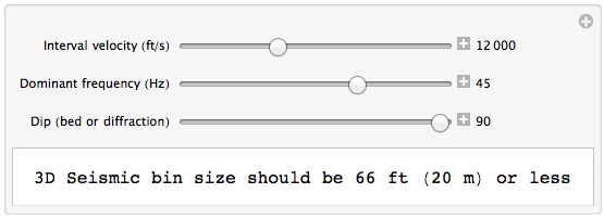
Title : Simple 3 D seismic bin size manipulator
Version: Mathematica 9.0.1.0
Author : Christopher Liner (U Arkansas)
Date : 21 May 2014
Status : Open source
Interface image:         


The download comes from my dropbox. Of course, the notebook is only useful if you have Mathematica.  Can't help you there.  Compatibility issues with different version of Mathematica may pop up.  If you get complaints about the notebook being from a newer/older version, just push on and it will likely work. Perhaps Scott could test the notebook and report back via blog comment.

Monday, August 25, 2014

Greater Northwest Arkansas

It has taken some serious time and effort, but I can finally make GMT dance a little bit.  This map uses the NOAA ETOPO1 elevation model (1 arc-minute grid) that is a 933MB file for the entire earth surface.  Fayetteville AR (FAY) is shown as red dot, with high-elevation Boston Mountains south and East of the city. Red outline is the MArkUP study area in which we are researching Mississippian carbonates.  

Friday, August 22, 2014

Petroacoustics Book (free online)

I got this email today from Patric Rasolofosaon, whom I met at my DISC lecture in Paris. He is a world authority on poroelasticity and has a new book co-authored with Bernard Zinszner.  They have altruistically made the book free online. Chapters 1-3 (of 7) are available now

It is a rare treat when a first-class scientist writes a book synthesizing the state of knowledge and experimental evidence in any field.  On behalf of geophysicists everywhere, thank you Patrick (and Bernard)!

--------------------------------------------------------------------

Dear Colleagues,

My co-author, Bernard Zinszner,  and myself are pleased to announce the publication of our book entitled ‘Petroacoustics – A tool for Applied Seismics –‘ on the website of the eBooks of IFP Energies nouvelles
(http://books.ifpenergiesnouvelles.fr/ebooks ... Free download!).   We are very much interested in your feedback. So please do not hesitate to contact us.

By the way, please could you pass the info among your students. Indeed we are also very much interested in  Students' feedback.  Because as we wrote somewhere in the book,  the Rock Acoustics courses taught at IFP School and at the Universities Pierre et Marie Curie and Denis Diderot of Paris, and the numerous questions of the students have also greatly stimulated the writing of this book.

Thanks very much in advance for passing the information.

Best regards,

Patrick Rasolofosaon and Bernard Zinszner

---- Patrick N.J. Rasolofosaon --------
IFP Energies nouvelles
Geosciences division
Geophysics-Geomechanics Department
1 et 4 avenue de Bois Préau
92852 Rueil Malmaison - France
tel: 33(1)47.52.68.53

---------------------------------------

P Please don't print this e-mail unless you really need to.

Friday, August 15, 2014

OpendTect project portability

I have been doing many 3D seismic interpretation projects recently using OpendTect (OD). I have written elsewhere about its many wonderful features, but for the last week it was driving me nuts.

The back story is that I work across four different machines: Mac laptop, home iMac, office Mac Pro, and office windows machine.  OD data directories are on each machine, plus a common repository on my 1.5TB USB drive.  That is 5 data locations that have to be synced as interpretation goes forward.

When you start using OD, an OD data directory must be established and this holds project folders.  Within each project there are several folders to hold various kinds of information and files:


Two kinds of files are at issue in this note, session and horizon files.  First, session files (xxx.sess) live in the Misc directory and hold information to restore workspace exactly as it was when you saved the session.  Second, horizon files are stored in the Surfaces directory.  As a horizon is created, tracked and then saved, two files are created (xxx.hor and xxx.ts).

Now to the issue.  Earlier this week I was working on a small area inside a 3D seismic survey in SE Kansas.  I limited the work area, got a couple of lines open and a time slice, tracked new horizons (Miss and Woodford), then saved the session.  All this was on my laptop.  To sync my USB version of the OD data, I dropped the session file into the appropriate Misc folder and the horizon files into the Surfaces folder.

Later in the week, I was working at home and copied the new files to my OD directory on my iMac, launched OD, and opened the new session file. Or at least attempted to.  That is the rub, even though I could see the new .sess file from the Mac finder (it was there), the session load dialog box in OD did not show it.  The same thing happened with the horizons, they were there in the correct folder but OD did not see them for loading.

I suspected different operating systems (nope, all same version of OS X), different OD versions (nope, all 4.6).  I examined the new session file and compared to older ones that loaded; was there any difference in permissions or other properties? Nope.  Suspected the creation date was the issue, so manually changed it with unix command line; nope. Only the machine that created the session file could see it, ditto for surfaces. This cut right to the heart of project portability.

Diving into the Misc directory with a unix command line, I noticed an invisible .omf file.  Looking inside I saw something like this:
dTect V4.6
Object Management file
Fri 15 Aug 2014, 09:43:20
!
ID: 100070`7
!
Misc: 1
Miscellaneous directory: dGB`Stream
$Name: Misc
!
Radcliff: 2
Session setup: dGB`Stream
$Extension: sess
$Name: Radcliff.sess
#Created.At: Mon 14 Apr 2014, 18:25:14
#Created.By: Steve Milligan
!
Then it dawned on me. This is a database file that is updated when a new session or horizon is created.  By only copying the .sess or .hor/.ts files to other machines, the .omf did not get updated on that machine and therefore the new files could not be loaded.  Eureka!!

So the answer (now) is simple.  OpendTect project portability is a snap.  When you create a new horizon or session and want to port it to another machine, drag the whole Misc or Surfaces folder to the new machine and replace the old folder.  The .omf file goes along for the ride and your work will be available on the new machine.  Sweet.

Followup note: OD uses these invisible dot files as a native unix database. I find this far superior to other interpretation systems that hook into a commercial database.  In teaching my 3D seismic interpretation class, we have up to 30 students working across a network via shared drive. Database problems always arise requiring IT staff intervention, a major pain that can be completely avoided with OD. Maybe for some level of complexity a commercial database is necessary, like too many wells or surfaces or multiple users interpreting the same project. But I have not yet bumped into that limit. The chance to run an interpretation class across multiple platforms without any database is very appealing.

Thursday, August 14, 2014

Latest Ozarks Stratigraphic Column

Save As... for full resolution version


Sunday, July 27, 2014

Irregular xyz data and GMT

After much tribulation (I will spare you the embarrassing details), I was finally able to install GMT on a macintosh and figure out the cryptic, yet powerful, GMT commands and options.

Mississippian tops gridded and displayed using open source GMT software. For well tops there are other tools, but for gridding general (x,y,z) data this is fabulous.

Might not seem like much, you could probably do it in Petra, Matlab, etc. But how about 1200 electrical conductivity values? No problem, but forget about posting the data values, just points this time.

About 1200 ground conductivity readings from an EM31 meter.  Negative values indicate metal objects in the near surface.  Conductivities between 5-20 mSm relate to areas with fresh groundwater.  High values (>30) probably represent shallow contamination by a conducting agent.

Here is the content of the raw text file miss.xyz, columns are (line, trace, depth)


101 70 2103
102 78 2130
101 64 2102
90 72 2103
91 64 2094
93 58 2107
78 70 2092
93 82 2088
66 82 2115
69 71 2106
69 60 2108
69 48 2138
36 21 2150
102 46 2160
66 21 2165
101 70 2103

Sunday, July 20, 2014

Research cruise on Beaver Lake

Beaver Lake in NW Arkansas has 480 miles of shoreline along the flooded White River valley, much of it with important geological exposures. Our first exploration trip on July 18 logged 34 new locations and 700 high resolution photos for lab analysis.

Measuring section

A kayak (exactly 10 ft long) is a convenient scale bar when operated near the rock face.  Students John Gist (shown) and Thomas Liner are experienced kayak pilots, a benefit of growing up in Arkansas. 

Miss Boone outcrop L160 with kayak near face for scale and water line as natural level.
Import photo to ImageJ, zoom to Kayak and pull line tip-to-tip, then set scale of this distance to 10 ft.  Walah, a scaled photo with 0.1 ft resolution.  Of course, there is a bit of distortion above the line of site, but certainly more accuracy than a graduate student hanging off a rope down a 100 ft cliff. 

Full image with a few elements marked up using ImageJ. Since the Boone is known to be about 300 ft thick, this one site represents about 1/3 of the entire formation.

Candid moments

MS Students John Gist (L) and Thomas Liner (R) on lunch break.


A fine Mississippian outcrop, or is it a lake crop?

Guest Robert Liner of Stephens Production supervising.


Tuesday, July 15, 2014

MArkUP Progress Timeline

2014 

July 18... Research float on Beaver Lake out of War Eagle Marina to catalog lakeside Miss outcrops. (U Arkansas: C. Liner, J. Gist, T. Liner. Stephens Production Co.: R. Liner.  Lawco Energy: P. Shelby)
July 16... GoogleEarth format finalized for MArkUP outcrop locations.  We currently have 149 sites inventoried.  Download kmz for site L149C
July 15... Liner manuscript iPhone Geology accepted for publication in September issue of World Oil Magazine (40,000+ subscribers in 127 countries) Download preview here
July 7... Based on discussions with Ron Doering, Liner signs contract with Springer for late 2015 book titled The art and science of seismic interpretation.  This will be a contribution to the SpringerBriefs in Energy.
May 2... Liner and MS candidate Alex West meet with Mac McGilvery of ConocoPhillips to discuss thesis work on Penn stratigraphy from 3D seismic data in northeast OK.
Apr 25... Liner presents MArkUP work at China University of Petroleum
Apr 11...
Richard Benson defends MS thesis: 3D Seismic Mapping of Probable Tripolitic Chert Bodies in Osage County, Oklahoma(Hired by Chesapeake Energy, OKC)
Caleb Jennings defends MS thesis: Mechanical Stratigraphy of the Mississippian in Osage County, Oklahoma(Hired by Schlumberger, Houston and Abu Dhabi)
Apr 10... Adam Martin defends MS thesis: Depositional History and Stratigraphic Framework of Upper Cretaceous (Campanian to Maastrichtian) Strata in the Minerva-Rockdale Oil Field of Milam County and Adjacent Counties, Texas. (Hired by Noble Energy, Denver)
Mar 27... Liner gives Heiland Lecture at the Colorado School of Mines on MArkUP project.
Mar 17... Liner talk at GSA Southcentral Meeting Upper Mississippian seismic reflection characteristics in Osage County, OK with co-authors Caleb Jennings and Richard Benson. Ron Doering of Springer was in the audience (see July 7, 2014).  Student poster at this GSA meeting by J. Gist and T. Liner, and oral presentation by K. Liner.
Feb 13... Liner talk to Ardmore Geological Society. Thanks to host Chuck Price.
Feb 10... Liner talk to Ft. Worth Geological Society, approximate attendance 100.  Thanks to host Melody Hacker.
Jan 28...Success running MJSystems LogSleuth software to get raster logs.  We have all of Arkansas and much of Oklahoma.  A key asset for our students.  Thank you MJSystems!
Jan 27... Liner talk to Geophysical Society of Oklahoma City, approximate attendance 100.  Thanks to host Kim Guyer.
Jan 25... Lauren Persing and Caleb Jennings GPR acquisition at Red River Crenshaw site.  Geomorphology study looking at recent river channels.

2013 

Nov 21... (1) Reached agreement with IHS for well scout data for complete state of AR. (2) Completed MJSystems donation of well log data for parts of OK (T12-29N R21-27E;   118,932 wells; 251,879 logs; 300GB). Market value: $130K.
Nov 14... Liner talk to Geophysical Society of Tulsa. Title: Geophysics on the Rocsk: Unsolved Mysteries of the Mississippian Outcrop
Nov 12... Liner talk to Tulsa Geological Society. Title: Mississippian Research in NW Arkansas
Nov 8... Final agreement with MJSystems for complete state of Arkansas log data (30,916 wells; 59,906 logs; 94GB). Market value: $29K.
Oct 29... Thank you to our wonderful data donors! (1) Initial agreement with MJSystems for donation of AR state well log data. Log data for parts of OK, KS, and MO to come later.  (2) Dovetail agreement with IHS for AR state well data is in process.  (3) Initial agreement with Southwestern Energy on 9 square mile 3D project data with wells, production, etc in Fayetteville Shale play area. 
Oct 15... Liner presentation at AAPG Midcontinent meeting along with 6 MArkUP student posters
Oct 9... APAC Hindsville Quarry GPR field work (tripolite!)
Oct 5...Geophysical equipment demonstration at Ozark Hall to Advisory Board and alumni.
Sep 25... Liner presentation at SEG Annual Meeting in Houston.  First SEG talk by U Arkansas geoscience faculty since 1984.
Aug 27...Physics/Geology double major plan approved by Geosciences faculty.
Aug 7...MArkUP newsletter emailed to friends and supporters of the project.  Download here
Aug 1…Seismic system acquisition test on Old Main lawn (see Seismos blog entry).
July 17/9...Liner does carbonate sequence stratigraphy fieldwork in Spain with Lluis Ardevol of Geoplay.
Jun 27/8...Mississippian research float on Buffalo River from Woolum to Gilbert. Liner, John, Caleb, Richard, and guest/guide Robert Liner. Dozens of sites documenting Lower Boone and Boone/St. Joe contact. 
Jun 24...First successful ground-penetrating radar (GPR) data test in MLK lab. For those new to GPR, an archeological case history can be found here.
Jun 18...Scout UA Cole Research Station near Goshen, AR.  Adjoining the site is an 80-foot exposure of Mississippian Lower Boone Limestone on the cut bank of the White River.  Site donated by mechanical engineering professor Jack Cole, who was guide for the site.  Discussions are underway to propose this as a calibration test site for wireline logging, surface seismic, cross well seismic, and civil engineering near-surface site characterization.
Jun 15...Abstract accepted to Houston SEG Annual MeetingGeophysics on the rocks: Unsolved mysteries of the Mississippian Outcrop (PDF)
Jun 12...Liner meets  UA Physics Professor Gay Stewart to scope out (1) Geology minor for Physics majors, and (2) Physics/Geology double major. The double major would require little modification of the existing BS Geology program and prepare undergrads to attend top US schools for grad work in Geophysics.
Jun11...Expanded Osage County, OK Pearsonia 3D survey SMT project with abutting Antelope 3D survey (credit to Steve Milligan).
Jun 6...Liner tours Century Geophysical production facility in Tulsa.  Considering a purchase of well logging equipment including gamma and electric logs,  full wave sonicacoustic televiewer, and caliper. Initial use would be logging of water wells to characterize Miss Boone limestone in NWA area as a supplement to outcrop and existing log data. 
Jun 4...First pass on a comprehensive regional Mississippian bibliography.
May 30....All available Arkansas Geological Survey quadrangle geology maps and worksheets in Google Earth (credit to John).
May 29...Return GPR equipment for checkout/repair (transmitter, receiver, network interface controller, fiber optic connectors). ETA for equipment return is two weeks.
May28....Research Mississippian float on Kings River; from Rockhouse to Kings River Outfitters. Liner, John, Richard, and guest Robert Liner. Locations documented = 15.
May 24.... Field trip Penn/Miss: Liner, John, Richard, Caleb and Thomas.
May 22...Nemaha Resources contributes fullwave sonic data for two wells in Chautauqua County, KS.
May 15.... (1) Liner meets with Tim and Pat Shields (Ft. Smith) to discuss Boone gas production in Batson and Ozone fields of the Arkansas Arkoma Basin.  The data they have includes N-S regional 2D seismic lines from the Arkoma Basin north toward the Ozark Plateau.  Digital data may be available. 
(2) Met with Robert Liner (Stephens Production Co.) who developed a Petra project template for MArkUP subsurface work in NW Arkansas. 
May 8....Granite fieldtrip to Spavinaw, OK with side trip to Picher, OK. Liner, Kevin, Thomas, John, Steve Milligan and Robert Liner. Outstanding. Also found granite wash and measured adjacent dips. 
May 7.... (1) Briefing by recent MS graduate Brett Whitmann about large Petra subsurface project containing Miss Lime information in several thousand wells across norther Oklahoma. This will form the nucleus of a MArkUP Petra project ultimately spanning the entire Miss Lime oil play and into the outcrop area of NW Arkansas.   
(2) APAC Hindsville Quarry visit: Liner, Doy and Liz.  Great projects here!
May 2.... Research posters for Department Spring Banquet presented by all MArkUP students.
Apr 28.... First 3D seismic interpretation class at U. of Arkansas completed (taught by Liner).
Apr 25....(1) Meeting with Alex Warmath (K3 Exploration) to plan donation of 3D seismic and well data in Lane County, Kansas.
(2) APAC Sharp's Quarry visit: Liner, Zachry, Manger, Liz, Richard, John, Thomas and Reid.
Apr 24....Thesis Proposal, Adam Martin, Navarro SS in Minerva-Rockdale Field, TX.
Apr 3....APAC Avoca quarry visit: Liner, Zachry, Manger, Liz Marchese, and Reid Beecher (SLB).
Apr 2.... (1) All seven abstracts submitted for AAPG Mid-Continent Meeting are accepted.
(2) Presentation to Ft. Smith Geological Society, MArkUP: An unconventional look at the Mississippian.
Mar 22...Liner submits abstract to SEG Annual MeetingGeophysics on the rocks: Unsolved mysteries of the Mississippian Outcrop (PDF).
Mar 21...Software ordered: IXRefraX from InterpeX (refraction analysis for near-surface model)
Mar 18...Liner attends SAGEEP meeting.
Mar 14.....Liner on Brad Smith well site inspection (850 ft water well S. of Prairie Grove).
Feb 28....MArkUP presentation to GeoHog alumni group in Houston.
Feb 26....7 abstracts submitted to AAPG mid-continent meeting.  Also, equipment ordered; Geometrics Geode system (48 ch, 1C and 3C phones, hammer source).
Feb 22....Lawco Energy donates Osage County, OK well log data.
Feb 21....Osage Mineral Council donates Osage County, OK 3D seismic data (Antelope, Big Heart, Gray Horse, Hominy, Wild Creek)
Feb 13....Paper accepted; Convolutional Time-Lapse Seismic Modeling for CO2 Sequestration at the Dickman Oifi eld, Ness County, Kansas (Geophysics, Liner 2nd author)>
Feb 8.....Liner meeting with Senator Jim Hendren (Gravette)
Feb 5....(1) Equipment ordered; Sensors & Software Ground Penetrating Radar system (50, 100 MHz).
(2) Proposal submitted: NSF CZO ($5M, Liner Co-PI)
Feb 1....Presentation to Marathon Oil Corporation in OKC office
Jan 31...Presentation to GeoHog alumni group in OKC
Jan 28...2nd Sponsor (in-kind) Schlumberger (wireline logging service in multiple wells TBD, including triple-combo, FMI, and ECS or Litho-Scanner)
Jan 25...1st Sponsor (in-kind) APAC-Central (HSE training for UA personnel and quarry access, beginning with Avoca quarry)
Jan 17...Current students; Adam Martin, Caleb Jennings, John Gist, Kevin Liner, Richard Benson, Thomas Liner.
Jan 7.....Equipment ordered: Geonics EM-31 conductivity meter

2012 

Dec 20....Stephens Production Co. donates Eagleford 3D seismic data (Pedernales) 
Nov 28....Mac McGilvery (MS Arkansas, PhD Texas) awarded Adjunct status
Nov 19....Spyglass Energy Group donates Osage County, OK 3D seismic and well data (Pearsonia)
Nov 14....Mississippian field trip with Atlas Energy L. P.
Oct 20.....Pennsylvanian field trip for type Morrow
Oct 19.....Presentation to UA Geosciences Advisory Board
Oct 11.....FairfieldNodal donates Gulf of Mexico 3D seismic data (UofHGoM) 
Aug 14....Liner joins UA as Maurice F. Storm Endowed Chair in Petroleum Geology